Colorado River, below Hoover Dam | SouthernPaddler.com

Colorado River, below Hoover Dam

tw541

Active Member
Feb 18, 2008
35
1
Mountain Home, Arkansas
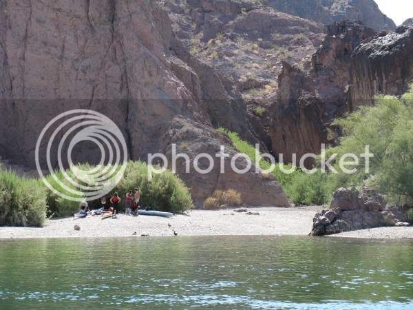
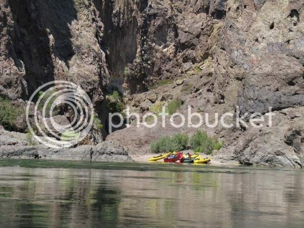
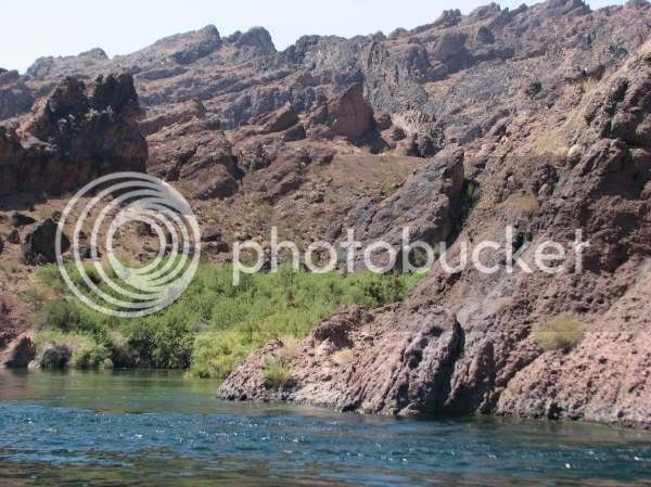
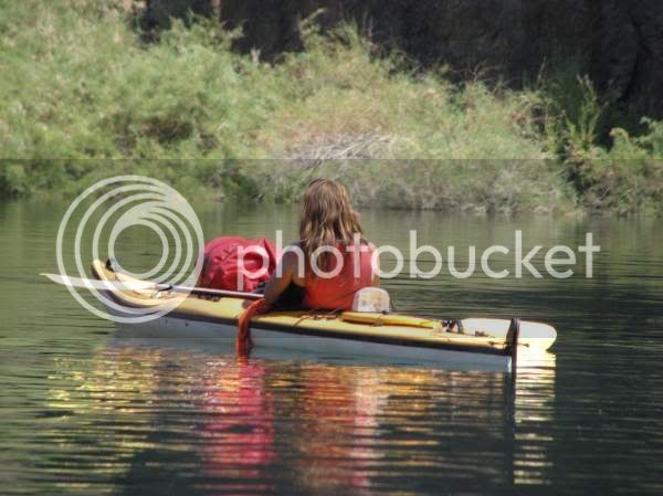
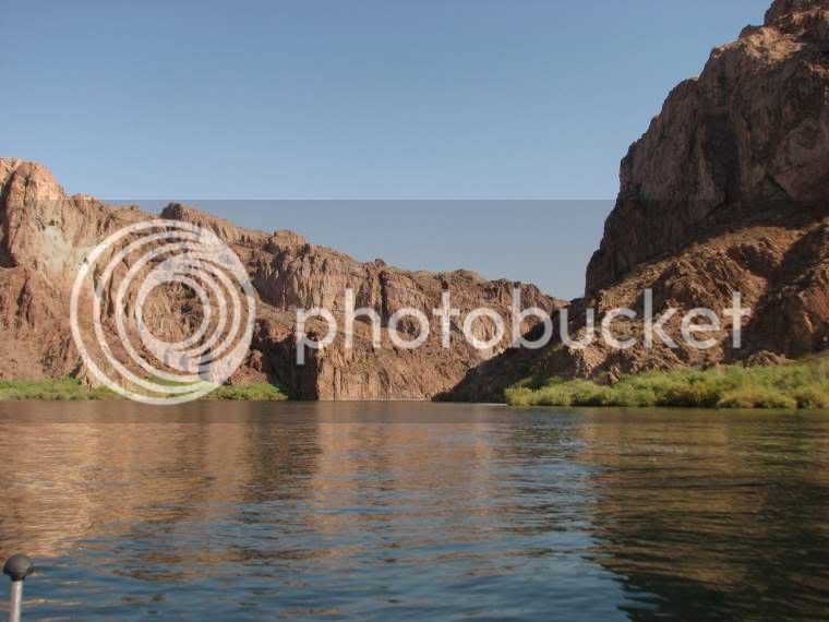
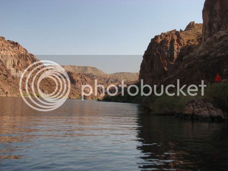
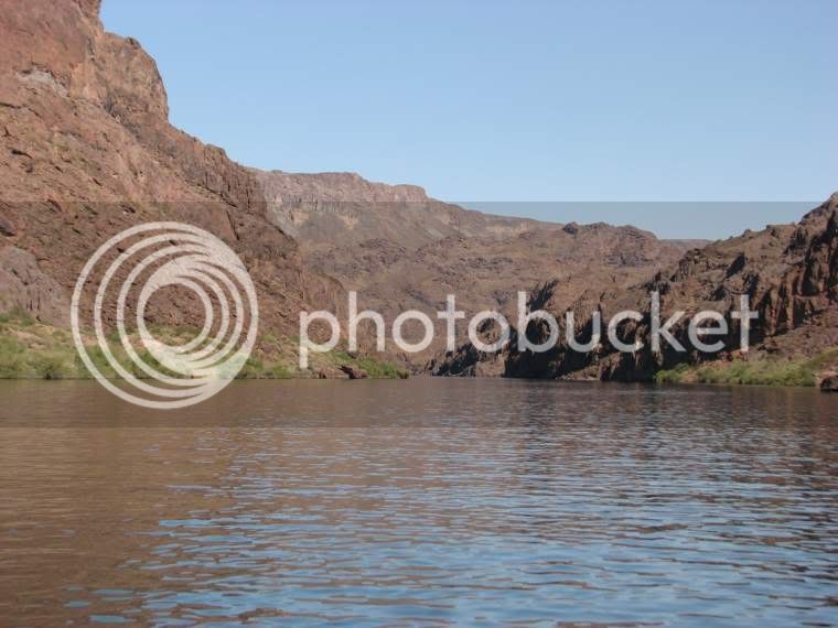
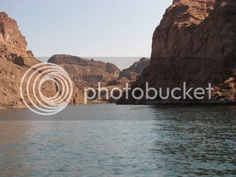
I decided to take a day off from my boat building and take a little river trip. This is the Black Canyon area of the Colorado, from the dam down to Willow Beach. We put in at Willow Beach about 7:00 AM. It was already 93 degrees then. We took out about 11:30, it was 109 degrees then. By the time we got home it was 115. Normal for here. We were in my bass boat, I could not explore the narrow side canyons and numerous caves like I would have in a paddle craft. There are 10 pictures here. I apologize to the folks on dial up, but I had a hard time deciding which pictures to use. Between me and my wife, we took about 700 pictures today. Cutting it down to only 10 was the problem. We always feel we should get home with full memory cards and low batteries in our cameras! My wifes new 8 meg Canon took over 400 pictures on the two AA rechargeables it uses. This was at maximum resolution. Pretty impressive.

4299.jpg


4304.jpg


4331.jpg


4348.jpg


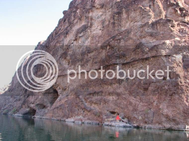
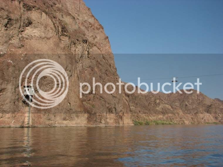
I was told this was a river gauging station. The operator hiked in a pretty good ways, and crossed a canyon on the Arizona side with a cable trolly. He then walked along on this walkway on the rock face, and crossed the river with another cable trolly to the station on the Nevada side. The trollies have been moved to the center of the spans to keep people off of them.

4278.jpg


4286.jpg


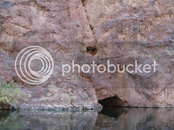
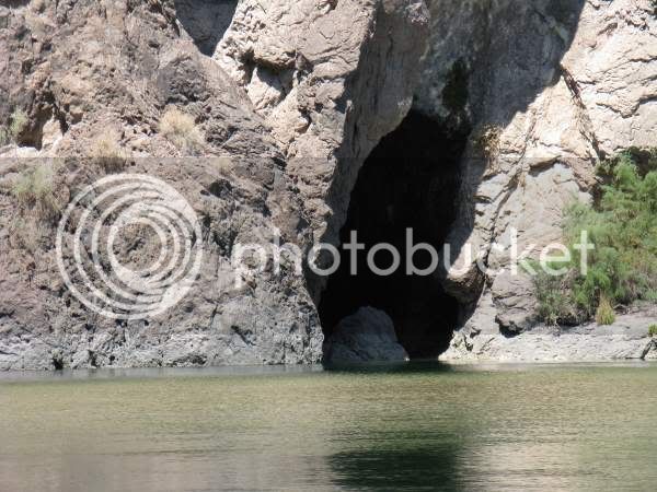
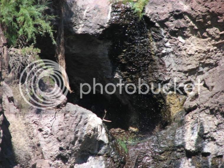
This is the first small waterfall we saw, at the entrance to a small cave.

4351.jpg


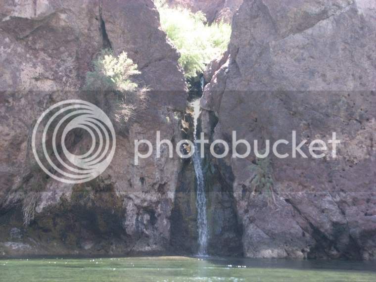
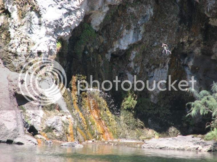
This is a slightly larger waterfall.

4414.jpg


Notice the water shooting out horizontally here. This water is hot. Notice the different colored algae growth.

4418.jpg


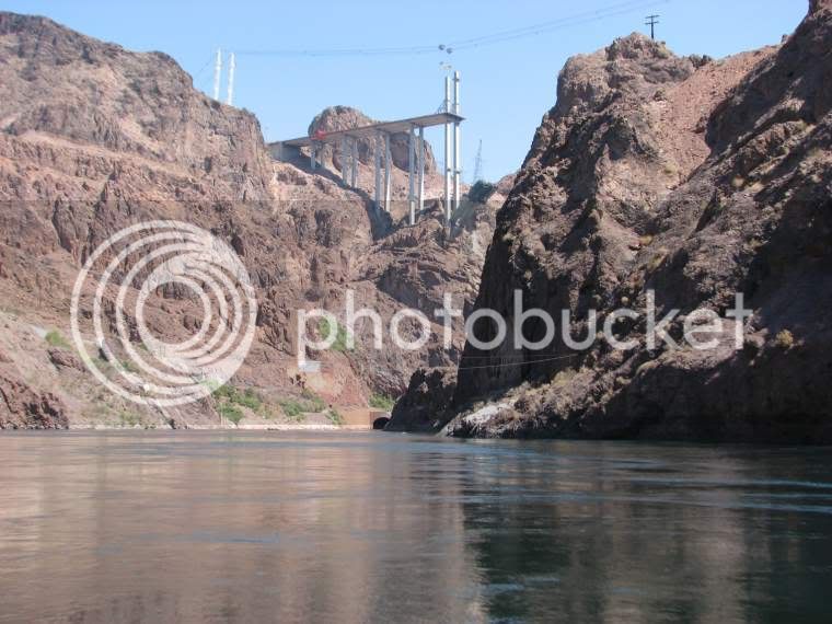
I was disappointed that we couldn't get to where we could see the dam. The sign on the cable says restricted area, do not enter. This is the new bypass bridge they are building below the dam. This bridge is only about a fourth of a mile below the dam. The dam is just around the corner in this photo.

4423.jpg


I'm hoping to do a float of the river next February or March. Too hot or too windy any other time.
 

bearridge

Well-Known Member
Mar 9, 2005
3,092
4
way down yonder
Friend Terry,

Ya'll done mitey good. One day we see Mick's Burrum, next day the Colorado River. What kinda flow? How long ta paddle? Do the dam folks try ta drown ya (like they do on the Brazos) 'er do they keep the level the same?

regards 'n thanks
bearridge

A fear of weapons is a sign of retarded sexual and emotional maturity. Sigmund Freud
 

tw541

Active Member
Feb 18, 2008
35
1
Mountain Home, Arkansas
Chuck

There a few pretty nice camp sites. In February or March, they should be be available pretty much anytime.

These folks were packing up to leave.

598.jpg


There were several groups of kayaks that were on the bank, appparently there was something interesting to see up the side canyons.

785.jpg


There were several caves that would be intersting to explore.

353.jpg


583.jpg


798.jpg


bearridge, the river level seems to be pretty stable. It depends completely on how much electricity the folks in California need to run their air conditioners. The river flow is completely dependant on the generating schedule. I have never seen it vary over a few feet from where it is now. In the winter, it is about 3 or 4 feet lower than in the pictures. The level came up about 6 inches while we were on the river. It doesn't vary much in February or March because the need in California is much less.

This is about as serious as this section of the river gets. No white water. When all turbines are running the current can get to about 5 knots. Even I can make good time going down river then.

4475.jpg


I stopped and asked if this young lady needed help, she said she was just floating along and reading a book.

4501.jpg


At least one of us had enough sense to get out of the sun.

865.jpg
[/img]
 

hairymick

Well-Known Member
Dec 8, 2005
2,107
2
Queensland, Australia
G'day Terry,

That is a cracking trip report and piccies mate. Thank you! 8)

I watched a show on building the Hoover dam a few days ago and was wondering what the paddling might be like downstream.

We have plenty of hot arid country like that only without the magnificent gorge.canyon and rivers running through. Certainly, nothing to compare with the majesty of that place. You are very lucky. With the heat there, I am surprised no one was swimming. I would have been wollowing in that magnificent river like a big old lizard. :lol:
 

bearridge

Well-Known Member
Mar 9, 2005
3,092
4
way down yonder
Friend Mick,

That water iz ice cold......shrivel yer bean. :mrgreen: It comes frum meltin' snow.

regards
bearridge

If tyranny and oppression come to this land, it will be in the guise of fighting a foreign enemy. James Madison
 

tw541

Active Member
Feb 18, 2008
35
1
Mountain Home, Arkansas
Bearridge is right. I've read that the water is 53 degrees year round coming out of the dam. It's crystal clear and looks inviting, but a little too cool for swimming. It's a popular trout fishing area, I've seen some huge rainbows come out of there. It's strange, but if you get in the shade of one of the bluffs, it's pretty cool. The water cools the air. I stood up in the boat and the air at face level was scorching. When I sat back down it was cool. One of the outfitters said many people take 2 or 3 days to float this 12 mile section. There are many interesting things to see in the side canyons. One canyon has stalactites formed on the walls. There are a series of pools fed by hot springs. Sauna cave extends back 100 feet where the water is heated up to 140 degrees. I think I could easily spend 3 days exploring this area.
 

hairymick

Well-Known Member
Dec 8, 2005
2,107
2
Queensland, Australia
Thanks guys.

Bloody strange country :shock: - huge, magnificent river flowing through desert in 100 plus heat and cold water. :D

No offense is intended, it just seems to be a contradiction in terms compared to what I am used to.

Here, our deserts don't have regularly flowing rivers. Our longest river system, the Murray/Darling combined, is little more than a drain compared to your Colorado River. :shock:
 

bearridge

Well-Known Member
Mar 9, 2005
3,092
4
way down yonder
Friend Mick,

Folks here dont take offense eazy.....'er we would be somewhere else. Take the High Sheriff fer example. :wink:

Aint many places on this earth like the Colorado comin' thru them canyons, which iz why it makes a tear roll when I think of all the dams that flooded all them canyons. Someday Mother Nature will learn 'em not ta mess with her. I hope it comes before the sand runs outta my hourglass.

Back before my preposterone leak, I wuz reachin' fer my checkbook 'n askin' a heap a questions bout me'n the Colorado River. There wuz a bunch of geezers frum Nashville who had run it in canoes (with big rafts totin' all the gear). I talked ta a friend of one of 'em. He sez they run most of the same rivers I run up in Carolina, so I figgered I mite be able ta keep the water under the boat. [This iz the big water upriver frum Terry's fine flatwater pichurs.]

A kayak paddlin' pal went down it with a group frum Jackson. We had paddled together on some real purty geezer water down in Southern Mississippi. He liked ta paddle the Ocoee over in Tennessee. I asked him if he figgered I kin make it down okay in my canoe. He sez most of the rapids aint technikle like the Ocoee, Chattooga, Nantahala 'er the French Broad, but they wuz dang BIG. They paddled it in the summertime. He sez he wuz burnin' up inside hiz wetsuit, but the water wuz like ice tea with plenty of cubes. He sez if he had ta swim, he would be mitey glad fer hiz wetsuit.

Plum crazy......100 degree air 'n 40 degree water. It dont rain much there, so a good bit of that water comes frum the winter time snow on the mountain tops which dont begin ta melt til summer. Me'n some other boy scouts had a snowball war in the July that time went ta the 50 year jamboree at Colorado Springs. Seen Yellowstone on that trip too.

If ya'll dont run outta time 'er dough, ya'll mite give some thought ta lookin' at the Grand Canyon.....mebbe take raft ride? I dont figger a homemade wooden boat, even Ron's, kin make it down that stretch of the Colorado in one piece. Some of them rocks will likely hit az hard az my carport roof. :mrgreen:

regards
bearridge

The worst form of inequality is to try to make unequal things equal. Aristotle
 

tw541

Active Member
Feb 18, 2008
35
1
Mountain Home, Arkansas
The water below Hoover dam stays the same temperature year round because it is coming from very deep in the lake. Even the surface water in Lake Mead is pretty cool though, because like bearridge said, it's from snow melt. It does seem strange to have water this cold in the desert. This is a very different river than in the Grand Canyon. The dams have really altered it.

Jack, this is one of the areas I was talking about. I am talking with an outfitter that does river shuttles about other areas. I would like to float the area from the dam, down to where lake Mohave starts, probably 2 or 3 days. Lake Mohave is no place to be when the wind gets up, it's dangerous even in a big boat. I would take out there and put in below Davis dam in Bullhead City, Laughlin NV. Float from there to Lake Havasu through Topock Gorge in the Havasu National Wildlife Refuge. It would probably take a week.
 

bearridge

Well-Known Member
Mar 9, 2005
3,092
4
way down yonder
The dam release water in the Nantahala iz ice cold cuz it comes frum Lake Nantahala way up on top of the mountain. It comes frum the bottom of the lake thru a big drain pipe. Even tho it aint mostly snow melt, it iz mitey cold.....took my breath the first time I turnt bottom upwards. It wuz my first trip, May, warm 'n sunshine made us squint. I never been on a canoe trip without beer, so I loaded a couple in the group cooler. Everbody else had a Coke. I run Patton's Run, made it past Pyramid 'n the other rapids up above Ferebee Park where our food 'n drink wuz waitin' (hid off in the poison ivy 'n ticks).

I wuz sky high cuz I made it ta the park dry. I sucked that first beer down like a thirsty sailor at the first honky tonk he come ta. We all laughed 'n talked bout the blue sky, the green mountains towerin' over us.....ate some baloney sammiches 'n Little Debbie snack cakes. I drank that second beer slower.

We loaded up 'n I got a big thrill at Delabar's Rock. Like a blind hog with a acorn, I wuz all smiles. My mind begun ta wander up inta the mountains when lo 'n behold this tiny rock, barely stickin' up outta the eazy movin' water caught me sidewise 'n daydreamin'. I leaned up stream 'n my big thrill turnt inta a big chill. I come up a drunk soprano. It took a while ta git my bearings. Someone sez "best git out before ya turn blue".

After that I drink water on the Nantahala.

regards
bearridge

Heckler: "Mr. Churchill, you're drunk!"
Churchill: "Yes, I am; and you are ugly. But tomorrow, I shall be sober."