
Jitterbug Cruise - 2011
Two years ago I enjoyed a 6 month cruise aboard my West Wight Potter-19, Jitterbug, beginning from my home in New Jersey, down the ICW to Ft. Lauderdale (2 months), out to the Bahamas (6 weeks) and then up the west coast of Florida to Ft. Myers where we crossed through the Okefenokee Waterway to the East coast for our return to New Jersey. Details of that cruise can be seen at…
viewtopic.php?f=6&t=6865&p=67362&hilit=jitterbug#p67362
This year I decided to take advantage of the Potter’s trailer-ability, thus allowing us more time to leisurely cruise the warm Gulf Coast of Florida. I say “us” meaning Jitterbug and I, this was another solo cruise. (I have no friends, at least none who are willing to sleep aboard a 19’ sailboat for 3 months.) The Northeast experienced a record level of snowfall, so on January 5, 2011 we were anxious to begin the 1,300 mile drive down I-95 to begin our warm weather adventure.

Snow in New Jersey
After 3 days of hectic driving, Jitterbug was launched at the historic Rod & Gun Club located in Everglades City, FL. This is also the location of the West entrance to Everglades National Park (the East entrance, at Flamingo, is some 90 miles distant). I was meeting friends, later in the month, for 5 days of camping within the Park boundaries so used the interim for a shake-out cruise in the Thousand Islands: All gear was in working order. An outstanding feature of the Potter is it’s ability to float in 8” of water with raised keel, thus allowing direct beach access. I also carry an inflatable Airies-10 for fishing/exploring small estuaries.
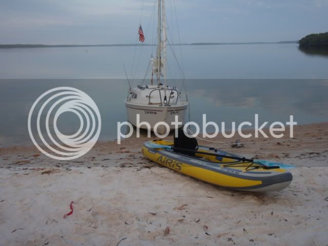
Jitterbug and her Dinghy
On Jan. 17, I returned to Everglades City to meet my http://www.Southernpaddler.com buddies. They obtained a 5 day ENP camping permit, while my permit included 5 days with them and an additional 9 days for cruising on to Flamingo. (Note: the maximum permit time is 14 consecutive days). The reason the Park requires a camping permit is to ensure that a site is available upon your arrival. Numbers are liberal on the beach sites, but are limited to one party on the chickee sites. Every site has a portable toilet, which are well maintained by the “honey boat”. A base camping permit is $10 and an additional $2 per day per person. So my 14 day permit only cost $38, which I feel is very reasonable.
Next morning we traveled to our first campsite, located on Jewel Key, about 14 miles distant. Mac and Chuck used a 14’ skiff while Joe motored the beautiful “stripper” he built many years ago. Joe was the founder of Liberty Yachts, FL which manufactured both sailboats and motor yachts up to 40’.
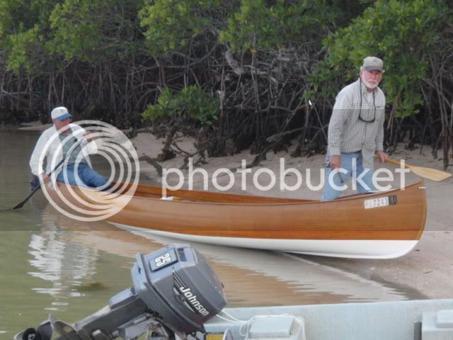
Mac and Joe at Jewel Key
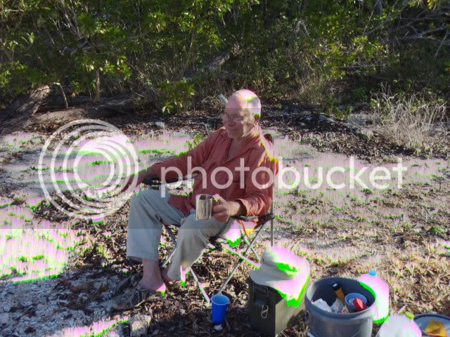
Chuck Takes it Easy
After 2 days of camping/fishing on Jewel Key, we moved on to our next site, Picnic Key, which was only 12 miles away. Unfortunately, we were socked-in with dense fog but my Garmin 540s, GPS saved the day. Chuck maintained his reputation as a rainmaker. It rained the first and last days of his stay, with lots of drizzle and dense fog in between. A detailed account of those five days can be viewed at
viewtopic.php?f=6&t=8309
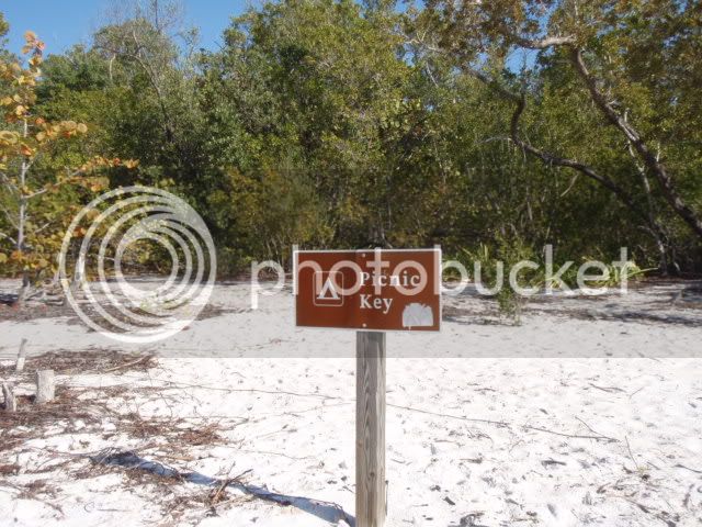
Picnic Key
Typical Chickee Campsite
On Jan. 21, I bid farewell to my friends and spent the remainder of the cruise solo. The first day alone I sailed 15 miles to the Chatham River and a campsite known as Watson’s Place, which was once a small sugar plantation. A very interesting story is told in the book, “Killing Mr. Watson”, by Peter Matthiessen. It gives insight into the hardships endured by those early settlers. There are remnants of machinery and buildings scattered throughout the Thousand Islands. The area is devoid of fresh water, so rainwater was captured and stored in cisterns: These old cisterns continue to provide freshwater for wildlife. The campsite has a small dock and two picnic tables. During my 2 day stay, several guide boats stopped by for a lunch break, affording me an opportunity to get the latest fishing info.
Water Cistern at Watson’s Place
Taking advantage of a westerly breeze, which put Jitterbug on a dead run, we sailed on to New Turkey Key. This is a small key that has eroded to the point of becoming two separate islands at mid-tide, but it has deep water access at one end which makes landing easy. I spent 2 nights there, fishing and exploring nearby keys during the day. There was never a problem catching enough fish for the table. On average, I probably enjoyed a fresh fish dinner three times per week.
Next stop was Ponce De Leon Bay, which is the mouth of Shark River, and provides a deep water, sheltered anchorage. It is a favored destination for cruisers making the 60 mile crossing to/from Key West. One morning I paddled the Airies-10 up little Graveyard Creek and spotted a saltwater crocodile sunning on the mud bank. They are much less numerous than freshwater alligators, so I later got a positive ID from a Flamingo Park Ranger. I estimated this one at 10’-12’, which is “respectable”. Since I was paddling a 10’ rubber kayak, he certainly got my respect!!

Saltwater Crocodile
The next 20 miles to Flamingo is a series of beautiful, long, desolate beaches the most notable being Cape Sable. Since there is little shelter this area is rarely frequented by sail, or power boats. But Jitterbug was right at home, affording me miles and miles of private beach combing territory. I spent the next five days slowly working my way along the beaches to Flamingo.
Jitterbug Beach Combing
Jitterbug carries 9, one gallon jugs of drinking water and another 16 gallons is stored in a bladder tank, so we still had an ample supply. Upon entering the marina at Flamingo, I was struck by the absence of boats. In fact, the only boat moored for the night was (of all things) another Potter-19! The boat was Serenity, owned by Pat Sammons, of Georgia, who was there for a week of solo sailing. He and I had a lengthy conversation which was of mutual benefit. I had planned to spend the night, but Pat was leaving that afternoon so I did the same. After replenishing the water supply, taking a long, hot shower and making some phone calls, (There is no cell phone service throughout much of the Park’s interior) I back-tracked 12 miles to East Cape, which was to be my launch point for crossing Florida Bay, to Key West. A direct crossing is about 55 miles but I elected to sail a dogleg route to Snipe Key (40 miles) and then on to Key West (25 miles). The additional mileage is justified because I don’t relish the prospect of a 12-14 hr watch at the tiller and I try to spend as little time as possible in open, exposed waters. Additionally, I am cruising in the strictest sense of the word, and not trying to reach any specific destination at a given time. “Retired and on vacation” - that’s me.
We crossed on Feb. 1 with breezes that allowed us to sail most of the way, but I was forced to start the outboard when the wind died and boat speed dropped to under 2mph. I located a few interesting coves near Snipe Key and spent an extra 2 days in the area. Upon arrival at Key West, I rented a slip for 5 nights at Garrison Bight City Marina. It was time to roll up the kayak and get out the folding bike - a Dahon, Curve model. Both the bike and the kayak easily store in Jitterbug’s starboard sleeping berth. Key West was a welcome change after 3 weeks of solo cruising in remote areas. I was ready for a little “civilization” time - dinners on Duval Street, bikini watching on the beach, and nightly entertainment at Malory Square - not a bad way to spend a week, or longer.
Located between Key West and the Dry Tortugas, lay a string of uninhabited keys that are part of a National Sanctuary. Several of these keys have long, white beaches that are open to the public. They became my next destination. A favorable wind allowed Jitterbug to sail 13 miles, to Boca Grande Key, in just 3 hours, which is moving for a heavily loaded Potter. Being located so near to civilization, this key sees a lot of day traffic from power boats seeking a bit of privacy and guide boats fishing the flats. A steep drop off allowed me to beach Jitterbug. We remained for several days before sailing12 additional miles to reach the Marquesas Keys. This set of keys forms an atoll and they are situated far enough from Key West to exclude most day trippers. Only a few cruisers, and professional crab boats anchored in the lee of the island during the 5 days that I spent there. Fishing was fantastic!! This photo is not digitally altered, the Spanish Mackerel and Jack both hit the lure at the same time.
Double Header on a Lure
The return to Key West was hampered by dead-on-the-nose winds, so I used the opportunity to troll the reef under power, catching many fish along the way. Rather than return directly to a marina, we anchored just off Key West, by Wisteria Island, for 2 days. Many, many cruisers, and some year-round squatters, anchor here. During the peak season it resembles a floating city. There is a dinghy dock in the horbor and a pump-out boat makes weekly rounds to empty holding tanks. A few sailors stopped by to chat, which is always interesting conversation. I then returned to the marina, there to await winds favorable for again crossing Florida Bay, this time back to the mainland. Four days later, on Feb 22, I was again walking the pristine beaches of Cape Sable.
Miles of Beach
Next day we sailed on to Shark River where Jitterbug would be protected from any threatening weather. Upon arrival at the bay, I noted both sting rays and tarpon making spectacular leaps, presumably as part of a mating ritual. I was very keen to land a tarpon so spent the next 3 days giving it my best shot. Without live bait, which most of the guide boats use, my only recourse was to make hundreds of casts with a variety of artificial lures. The net result for all of that effort was 2 hook-ups over a 3 day period; one spit the lure on the first leap and the second broke the line. By the end of that third day I was totally exhausted from casting those large baits and conceded to the tarpon - but just for now.
Time for a change of scenery and the city of Naples seemed like just the ticket. After plotting a course, I vowed to sail the entire distance - no motor. Jitterbug made 23 miles the first day, to New Turkey Key, and 24 the second, to Picnic Key. On the third day we caught a perfect breeze that enabled a 36 mile direct course to Gordon Pass, the entrance to Naples. Jitterbug loves the Gulf waters! We rented a slip at the City Marina for 4 nights. Unfortunately, they impose a minimum fee which is for a boat length of 30’, so little Jitterbug was charged the same rate as the larger boats - $47 per night. Naples is an upscale community of large homes with immaculate landscaping; every lawn looks like a putting green. The city offers four star dinning, a fabulous fishing pier, clean beaches and exclusive shopping. I thoroughly enjoyed the stay, taking long bike rides and beach walks daily. I also enjoyed breakfast and dinner at two of my favorite little resturants. Steak and eggs were a welcome change from my diet of fish, rice, and noodles. The maximum stay for live-aboards is 4 consecutive days, so on March 4 we set sail on a northerly course, towards Ft. Myers.
Jitterbug was still blessed by the wind gods and easily sailed 20 miles up the Gulf coast to arrive at Lover’s Key State Park by mid-afternoon. This is one of my favorite cruising locations. It is located on the south side of Big Carlos Pass, across from Fort Myers Beach ( Estero Island). There is deep anchorage at both ends of the island, while mid-island is accessable by auto from the mainland. Needless to say, it gets somewhat crowded on weekends and I happened to arrive on a Saturday; but it’s a fun crowd, a mix of bathers and fisherman. The mile-long beach is a pleasure to walk because there are toilets and a concession stand at the midway point; nice stop to enjoy an ice cream. The back side of the island is a maze of mangrove coves and fishing is excellent. We anchored there for 2 nights before continuing on to Fort Myers.
Mangrove Coves
It took 2 days to reach Fort Myers, sailing 17 miles the first day to anchor at Shell Point, then motoring up the Caloosahatchee River on the second day. This is the beginning of the Okechobee Waterway, which cuts across the state to the East coast. I might mention that the Waterway locks closed, late in March, due to severe drought conditions. During our entire 3 month cruise it only rained 2 days; Jan. 17th & Jan 21st, the days my camping buddies arrived and departed. - another reason to travel solo??
Fort Myers City Marina does not apply the dreaded 30’ minimum docking fee, so expenses for small craft are much less. The downtown section had suffered an economic decline but is slowly being rejuvenated, now featuring a number of new resturants and art galleries. But of course the most famous attraction is Thomas Edison’s home and laboratory. I enjoyed a 4 day visit of bike riding, a live theature show and a bus trip to Fort Myers Beach, which was mobbed with the college Spring Break crowd.
By March 12 it was time to begin our return trip and we navigated all the way back to Lover’s Key in a single day, this time anchoring at the south end of the island, in New Pass. The fixed bridge over the Pass has a clearance of 30’, which Jitterbug can sneak under with her 27’ mast height. Fishing was good for both sheephead and sea trout so we stayed 3 days before moving on to spend another few days in Naples.
From Naples I elected to take the coastal route, so we stayed just off Keewaydin Island; the southern end of which is Rookery Key Rerserve. There is a great anchorage on the back side that is very popular with cruisers and power boats alike - quite a contrast to the beaches in the Everglades!
Rookery Key
Next stop was beautiful Cape Romano, which lies south of Marco Island. At one time this area was destined to become another playground for the wealthy, and a few beachfront homes were constructed at great expense. But (fortunately) Mother Nature had other ideas and the end of the island was severely eroded during a hurricane. One of the homes still stands as a stark reminder. The entire area is now a state park but is much less crowded than those located closer densely populated areas.
Cape Romano
Since leaving the Shark River area I often recalled the spectacular leaps made by the tarpon that I had briefly hooked. So, I determined to give it another try and sailed all the way back to Ponce De Leon bay with only a one night stop at Pavillion Key. Upon entering the bay I noticed quite a few more guide boats fishing the area. One advantage of spending the night is that I have the bay to myself in the early morning and evening. The tarpon were still there, but were mostly seen rolling rather than leaping as before. After one full day of fruitless effort, I was getting a bit discouraged. Early morning on the second day the water was mirror-glass calm, which made it easier to spot rolling fish. A small skiff arrived and the lone occupant began casting a fly rod. I figured his chances at about the same odds as me hitting the millionaire lottery. Well, a short time later he hooked a huge tarpon and I spent the next hour watching (from a respectable distance) him battle that fish - leap after spectacular leap. He was finally able to bring it alongside the boat and remove the hook without ever taking the fish out of the water. He was one happy dude, letting out a loud YES! and pumping his arms in victory. I was happy for him and resumed fishing with renewed enthusiasm. But alas, my efforts were in vain. Two more days of concerted effort only resulted in 2 hooked fish, both of which spit the lure on their first jump. Total tally: Tarpon-4 John-0. Just wait until next time!
Entering the last week of March, it was time to return to our starting point, Everglades City. We moved at a slow pace, relying 100% on sail power, spending several nights anchored off various keys, the last being Indian Key. The leisurely pace allowed time for reflection of the past three months; one subject being the various wildlife encounters. Bottle nosed dolphins were a constant companion, often playing at Jitterbug’s bow for hours, while diving osprey were also a daily sight: Lesser seen were manatee and bald eagles. And of course there were the spectacular leaps of manta rays and tarpon, and the occasional sighting of a black tip shark. Shore birds are too numerous to mention, but I will note that the pelicans are becoming much more aggressive, especially while one is cleaning fish. Another topic is the people one meets during such a trip. They ran the gamut from canoe/kayak campers to cruisers of luxury yachts. It struck me that the more expensive the boat, the less interesting, adventuresome it’s occupants. Those plying the waters in small craft (under 20’) talked of wildlife encounters and personal experience, while the “yachties” seemed more concerned with distance traveled and electronic gadgetry. A pocket cruiser like the Potter-19’ seems a perfect compromise between paddling and yachting. It is small enough to allow direct beach access, yet provides protection from the elements and biting insects.
Jitterbug was loaded onto her trailer March 29 and we arrived home on April 1 with lots of fond memories. Until next time…..
Sunset
Two years ago I enjoyed a 6 month cruise aboard my West Wight Potter-19, Jitterbug, beginning from my home in New Jersey, down the ICW to Ft. Lauderdale (2 months), out to the Bahamas (6 weeks) and then up the west coast of Florida to Ft. Myers where we crossed through the Okefenokee Waterway to the East coast for our return to New Jersey. Details of that cruise can be seen at…
viewtopic.php?f=6&t=6865&p=67362&hilit=jitterbug#p67362
This year I decided to take advantage of the Potter’s trailer-ability, thus allowing us more time to leisurely cruise the warm Gulf Coast of Florida. I say “us” meaning Jitterbug and I, this was another solo cruise. (I have no friends, at least none who are willing to sleep aboard a 19’ sailboat for 3 months.) The Northeast experienced a record level of snowfall, so on January 5, 2011 we were anxious to begin the 1,300 mile drive down I-95 to begin our warm weather adventure.
Snow in New Jersey
After 3 days of hectic driving, Jitterbug was launched at the historic Rod & Gun Club located in Everglades City, FL. This is also the location of the West entrance to Everglades National Park (the East entrance, at Flamingo, is some 90 miles distant). I was meeting friends, later in the month, for 5 days of camping within the Park boundaries so used the interim for a shake-out cruise in the Thousand Islands: All gear was in working order. An outstanding feature of the Potter is it’s ability to float in 8” of water with raised keel, thus allowing direct beach access. I also carry an inflatable Airies-10 for fishing/exploring small estuaries.
Jitterbug and her Dinghy
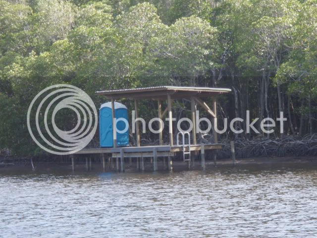
On Jan. 17, I returned to Everglades City to meet my http://www.Southernpaddler.com buddies. They obtained a 5 day ENP camping permit, while my permit included 5 days with them and an additional 9 days for cruising on to Flamingo. (Note: the maximum permit time is 14 consecutive days). The reason the Park requires a camping permit is to ensure that a site is available upon your arrival. Numbers are liberal on the beach sites, but are limited to one party on the chickee sites. Every site has a portable toilet, which are well maintained by the “honey boat”. A base camping permit is $10 and an additional $2 per day per person. So my 14 day permit only cost $38, which I feel is very reasonable.
Next morning we traveled to our first campsite, located on Jewel Key, about 14 miles distant. Mac and Chuck used a 14’ skiff while Joe motored the beautiful “stripper” he built many years ago. Joe was the founder of Liberty Yachts, FL which manufactured both sailboats and motor yachts up to 40’.
Mac and Joe at Jewel Key
Chuck Takes it Easy
After 2 days of camping/fishing on Jewel Key, we moved on to our next site, Picnic Key, which was only 12 miles away. Unfortunately, we were socked-in with dense fog but my Garmin 540s, GPS saved the day. Chuck maintained his reputation as a rainmaker. It rained the first and last days of his stay, with lots of drizzle and dense fog in between. A detailed account of those five days can be viewed at
viewtopic.php?f=6&t=8309
Picnic Key
Typical Chickee Campsite
On Jan. 21, I bid farewell to my friends and spent the remainder of the cruise solo. The first day alone I sailed 15 miles to the Chatham River and a campsite known as Watson’s Place, which was once a small sugar plantation. A very interesting story is told in the book, “Killing Mr. Watson”, by Peter Matthiessen. It gives insight into the hardships endured by those early settlers. There are remnants of machinery and buildings scattered throughout the Thousand Islands. The area is devoid of fresh water, so rainwater was captured and stored in cisterns: These old cisterns continue to provide freshwater for wildlife. The campsite has a small dock and two picnic tables. During my 2 day stay, several guide boats stopped by for a lunch break, affording me an opportunity to get the latest fishing info.
Water Cistern at Watson’s Place
Taking advantage of a westerly breeze, which put Jitterbug on a dead run, we sailed on to New Turkey Key. This is a small key that has eroded to the point of becoming two separate islands at mid-tide, but it has deep water access at one end which makes landing easy. I spent 2 nights there, fishing and exploring nearby keys during the day. There was never a problem catching enough fish for the table. On average, I probably enjoyed a fresh fish dinner three times per week.
Next stop was Ponce De Leon Bay, which is the mouth of Shark River, and provides a deep water, sheltered anchorage. It is a favored destination for cruisers making the 60 mile crossing to/from Key West. One morning I paddled the Airies-10 up little Graveyard Creek and spotted a saltwater crocodile sunning on the mud bank. They are much less numerous than freshwater alligators, so I later got a positive ID from a Flamingo Park Ranger. I estimated this one at 10’-12’, which is “respectable”. Since I was paddling a 10’ rubber kayak, he certainly got my respect!!
Saltwater Crocodile
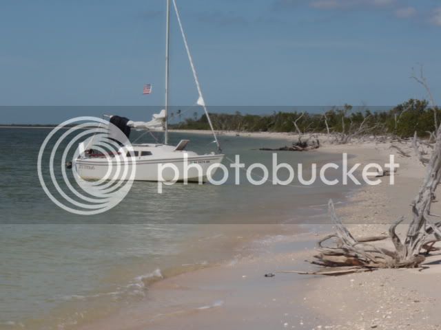
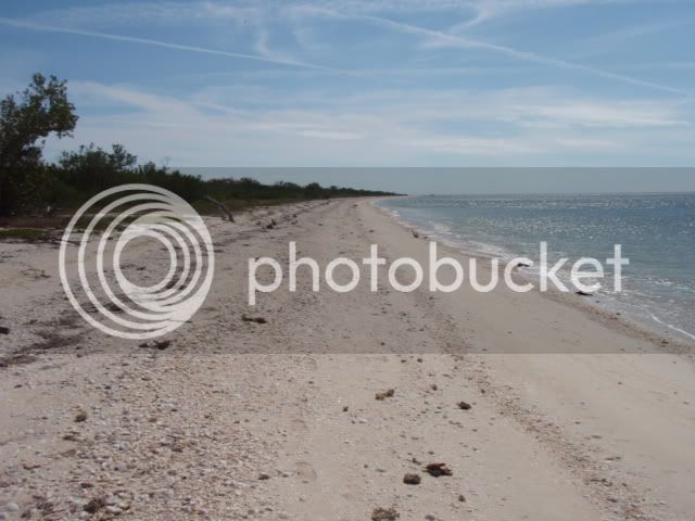
The next 20 miles to Flamingo is a series of beautiful, long, desolate beaches the most notable being Cape Sable. Since there is little shelter this area is rarely frequented by sail, or power boats. But Jitterbug was right at home, affording me miles and miles of private beach combing territory. I spent the next five days slowly working my way along the beaches to Flamingo.
Jitterbug Beach Combing
Jitterbug carries 9, one gallon jugs of drinking water and another 16 gallons is stored in a bladder tank, so we still had an ample supply. Upon entering the marina at Flamingo, I was struck by the absence of boats. In fact, the only boat moored for the night was (of all things) another Potter-19! The boat was Serenity, owned by Pat Sammons, of Georgia, who was there for a week of solo sailing. He and I had a lengthy conversation which was of mutual benefit. I had planned to spend the night, but Pat was leaving that afternoon so I did the same. After replenishing the water supply, taking a long, hot shower and making some phone calls, (There is no cell phone service throughout much of the Park’s interior) I back-tracked 12 miles to East Cape, which was to be my launch point for crossing Florida Bay, to Key West. A direct crossing is about 55 miles but I elected to sail a dogleg route to Snipe Key (40 miles) and then on to Key West (25 miles). The additional mileage is justified because I don’t relish the prospect of a 12-14 hr watch at the tiller and I try to spend as little time as possible in open, exposed waters. Additionally, I am cruising in the strictest sense of the word, and not trying to reach any specific destination at a given time. “Retired and on vacation” - that’s me.
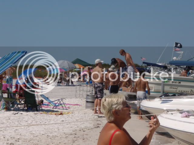
We crossed on Feb. 1 with breezes that allowed us to sail most of the way, but I was forced to start the outboard when the wind died and boat speed dropped to under 2mph. I located a few interesting coves near Snipe Key and spent an extra 2 days in the area. Upon arrival at Key West, I rented a slip for 5 nights at Garrison Bight City Marina. It was time to roll up the kayak and get out the folding bike - a Dahon, Curve model. Both the bike and the kayak easily store in Jitterbug’s starboard sleeping berth. Key West was a welcome change after 3 weeks of solo cruising in remote areas. I was ready for a little “civilization” time - dinners on Duval Street, bikini watching on the beach, and nightly entertainment at Malory Square - not a bad way to spend a week, or longer.
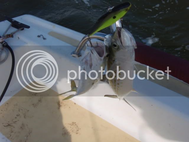
Located between Key West and the Dry Tortugas, lay a string of uninhabited keys that are part of a National Sanctuary. Several of these keys have long, white beaches that are open to the public. They became my next destination. A favorable wind allowed Jitterbug to sail 13 miles, to Boca Grande Key, in just 3 hours, which is moving for a heavily loaded Potter. Being located so near to civilization, this key sees a lot of day traffic from power boats seeking a bit of privacy and guide boats fishing the flats. A steep drop off allowed me to beach Jitterbug. We remained for several days before sailing12 additional miles to reach the Marquesas Keys. This set of keys forms an atoll and they are situated far enough from Key West to exclude most day trippers. Only a few cruisers, and professional crab boats anchored in the lee of the island during the 5 days that I spent there. Fishing was fantastic!! This photo is not digitally altered, the Spanish Mackerel and Jack both hit the lure at the same time.
Double Header on a Lure
The return to Key West was hampered by dead-on-the-nose winds, so I used the opportunity to troll the reef under power, catching many fish along the way. Rather than return directly to a marina, we anchored just off Key West, by Wisteria Island, for 2 days. Many, many cruisers, and some year-round squatters, anchor here. During the peak season it resembles a floating city. There is a dinghy dock in the horbor and a pump-out boat makes weekly rounds to empty holding tanks. A few sailors stopped by to chat, which is always interesting conversation. I then returned to the marina, there to await winds favorable for again crossing Florida Bay, this time back to the mainland. Four days later, on Feb 22, I was again walking the pristine beaches of Cape Sable.
Miles of Beach
Next day we sailed on to Shark River where Jitterbug would be protected from any threatening weather. Upon arrival at the bay, I noted both sting rays and tarpon making spectacular leaps, presumably as part of a mating ritual. I was very keen to land a tarpon so spent the next 3 days giving it my best shot. Without live bait, which most of the guide boats use, my only recourse was to make hundreds of casts with a variety of artificial lures. The net result for all of that effort was 2 hook-ups over a 3 day period; one spit the lure on the first leap and the second broke the line. By the end of that third day I was totally exhausted from casting those large baits and conceded to the tarpon - but just for now.
Time for a change of scenery and the city of Naples seemed like just the ticket. After plotting a course, I vowed to sail the entire distance - no motor. Jitterbug made 23 miles the first day, to New Turkey Key, and 24 the second, to Picnic Key. On the third day we caught a perfect breeze that enabled a 36 mile direct course to Gordon Pass, the entrance to Naples. Jitterbug loves the Gulf waters! We rented a slip at the City Marina for 4 nights. Unfortunately, they impose a minimum fee which is for a boat length of 30’, so little Jitterbug was charged the same rate as the larger boats - $47 per night. Naples is an upscale community of large homes with immaculate landscaping; every lawn looks like a putting green. The city offers four star dinning, a fabulous fishing pier, clean beaches and exclusive shopping. I thoroughly enjoyed the stay, taking long bike rides and beach walks daily. I also enjoyed breakfast and dinner at two of my favorite little resturants. Steak and eggs were a welcome change from my diet of fish, rice, and noodles. The maximum stay for live-aboards is 4 consecutive days, so on March 4 we set sail on a northerly course, towards Ft. Myers.
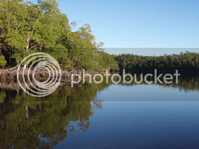
Jitterbug was still blessed by the wind gods and easily sailed 20 miles up the Gulf coast to arrive at Lover’s Key State Park by mid-afternoon. This is one of my favorite cruising locations. It is located on the south side of Big Carlos Pass, across from Fort Myers Beach ( Estero Island). There is deep anchorage at both ends of the island, while mid-island is accessable by auto from the mainland. Needless to say, it gets somewhat crowded on weekends and I happened to arrive on a Saturday; but it’s a fun crowd, a mix of bathers and fisherman. The mile-long beach is a pleasure to walk because there are toilets and a concession stand at the midway point; nice stop to enjoy an ice cream. The back side of the island is a maze of mangrove coves and fishing is excellent. We anchored there for 2 nights before continuing on to Fort Myers.
Mangrove Coves
It took 2 days to reach Fort Myers, sailing 17 miles the first day to anchor at Shell Point, then motoring up the Caloosahatchee River on the second day. This is the beginning of the Okechobee Waterway, which cuts across the state to the East coast. I might mention that the Waterway locks closed, late in March, due to severe drought conditions. During our entire 3 month cruise it only rained 2 days; Jan. 17th & Jan 21st, the days my camping buddies arrived and departed. - another reason to travel solo??
Fort Myers City Marina does not apply the dreaded 30’ minimum docking fee, so expenses for small craft are much less. The downtown section had suffered an economic decline but is slowly being rejuvenated, now featuring a number of new resturants and art galleries. But of course the most famous attraction is Thomas Edison’s home and laboratory. I enjoyed a 4 day visit of bike riding, a live theature show and a bus trip to Fort Myers Beach, which was mobbed with the college Spring Break crowd.
By March 12 it was time to begin our return trip and we navigated all the way back to Lover’s Key in a single day, this time anchoring at the south end of the island, in New Pass. The fixed bridge over the Pass has a clearance of 30’, which Jitterbug can sneak under with her 27’ mast height. Fishing was good for both sheephead and sea trout so we stayed 3 days before moving on to spend another few days in Naples.
From Naples I elected to take the coastal route, so we stayed just off Keewaydin Island; the southern end of which is Rookery Key Rerserve. There is a great anchorage on the back side that is very popular with cruisers and power boats alike - quite a contrast to the beaches in the Everglades!
Rookery Key
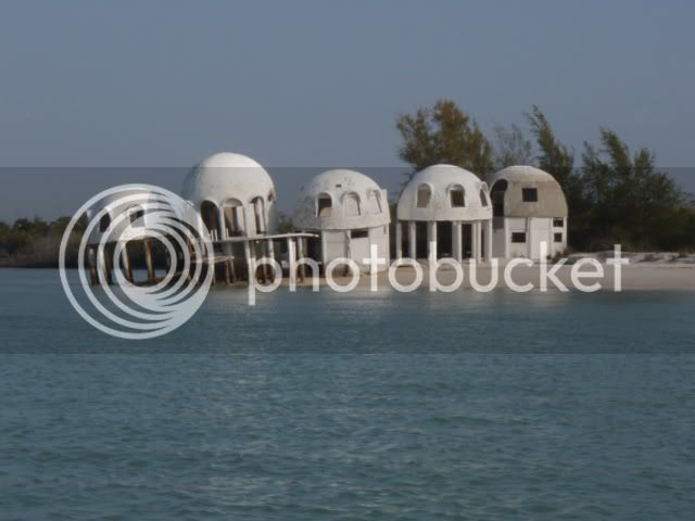
Next stop was beautiful Cape Romano, which lies south of Marco Island. At one time this area was destined to become another playground for the wealthy, and a few beachfront homes were constructed at great expense. But (fortunately) Mother Nature had other ideas and the end of the island was severely eroded during a hurricane. One of the homes still stands as a stark reminder. The entire area is now a state park but is much less crowded than those located closer densely populated areas.
Cape Romano
Since leaving the Shark River area I often recalled the spectacular leaps made by the tarpon that I had briefly hooked. So, I determined to give it another try and sailed all the way back to Ponce De Leon bay with only a one night stop at Pavillion Key. Upon entering the bay I noticed quite a few more guide boats fishing the area. One advantage of spending the night is that I have the bay to myself in the early morning and evening. The tarpon were still there, but were mostly seen rolling rather than leaping as before. After one full day of fruitless effort, I was getting a bit discouraged. Early morning on the second day the water was mirror-glass calm, which made it easier to spot rolling fish. A small skiff arrived and the lone occupant began casting a fly rod. I figured his chances at about the same odds as me hitting the millionaire lottery. Well, a short time later he hooked a huge tarpon and I spent the next hour watching (from a respectable distance) him battle that fish - leap after spectacular leap. He was finally able to bring it alongside the boat and remove the hook without ever taking the fish out of the water. He was one happy dude, letting out a loud YES! and pumping his arms in victory. I was happy for him and resumed fishing with renewed enthusiasm. But alas, my efforts were in vain. Two more days of concerted effort only resulted in 2 hooked fish, both of which spit the lure on their first jump. Total tally: Tarpon-4 John-0. Just wait until next time!
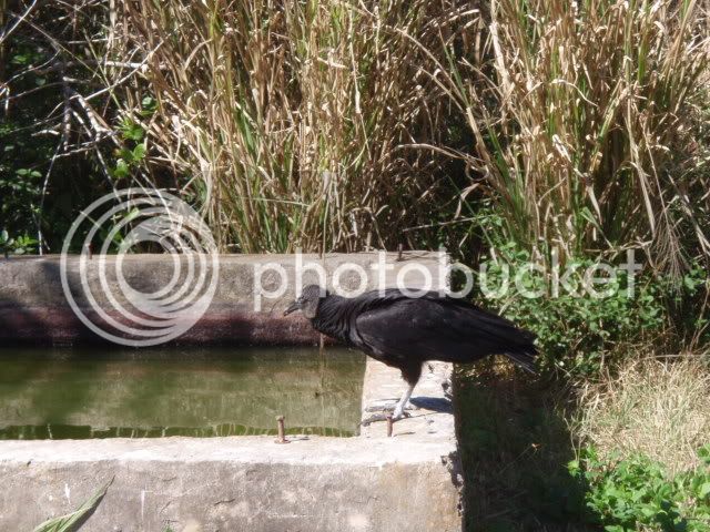
Entering the last week of March, it was time to return to our starting point, Everglades City. We moved at a slow pace, relying 100% on sail power, spending several nights anchored off various keys, the last being Indian Key. The leisurely pace allowed time for reflection of the past three months; one subject being the various wildlife encounters. Bottle nosed dolphins were a constant companion, often playing at Jitterbug’s bow for hours, while diving osprey were also a daily sight: Lesser seen were manatee and bald eagles. And of course there were the spectacular leaps of manta rays and tarpon, and the occasional sighting of a black tip shark. Shore birds are too numerous to mention, but I will note that the pelicans are becoming much more aggressive, especially while one is cleaning fish. Another topic is the people one meets during such a trip. They ran the gamut from canoe/kayak campers to cruisers of luxury yachts. It struck me that the more expensive the boat, the less interesting, adventuresome it’s occupants. Those plying the waters in small craft (under 20’) talked of wildlife encounters and personal experience, while the “yachties” seemed more concerned with distance traveled and electronic gadgetry. A pocket cruiser like the Potter-19’ seems a perfect compromise between paddling and yachting. It is small enough to allow direct beach access, yet provides protection from the elements and biting insects.
Jitterbug was loaded onto her trailer March 29 and we arrived home on April 1 with lots of fond memories. Until next time…..
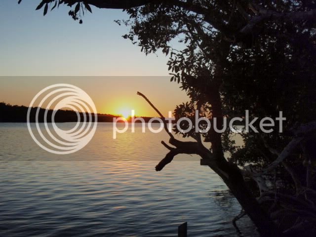
Sunset
")