
Last spring we were staying on Dauphin Island SW of Mobile, AL, and I had brought a canoe along. Many streams were too low due to persistent drought. I decided to try the lower Escatawpa, which snakes back and forth along the Mississippi-Alabama border before joining the Pascagoula. I planned to start out at Presleys Landing on Goodes Lake, just above where the Escatawpa starts to be affected by tides. Here's Goodes Lake and the Escatawpa from outer space.

EscatawpaSat by ezwater, on Flickr
Goodes Lake is about a mile and a half long, with a small creek at its head. The Escatawpa River comes in from the NW and just touches the south end of Goodes Lake. There are quite a few such lakes on the Escatawpa and similar "blackwater" rivers. I would guess that the river, in periods of high flow, has sucked the sand out of the lake basin through a kind of Bernoulli effect. I have not seen any such lakes where the river enters at the "top" end and leaves at the bottom.
You can also see the cut off meanders, and the obvious white sandbars. Around the river is mostly low ground, flood plain, populated by cypress in the wetter spots and by maple and oak in the drier spots.
Also visible from space are the motor homes lined up along a small canal. The proprietors at Presleys said for me to park and put in along their sand beach, which on a Friday was barely used. The weather was outstanding, temperature in the upper 70s F, and a cooling breeze just stiff enough to require attention. Here's a shot northward along the beach.
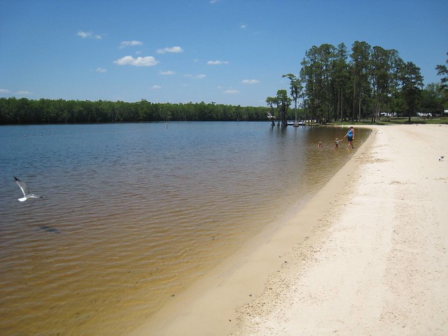
IMG_0012 by ezwater, on Flickr
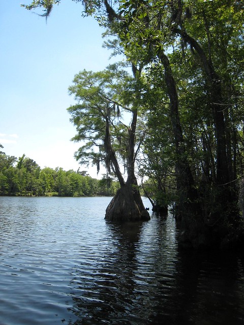
I paddled straight across the lake to poke around in the mass of cypress, willow, and oak along the west shore.
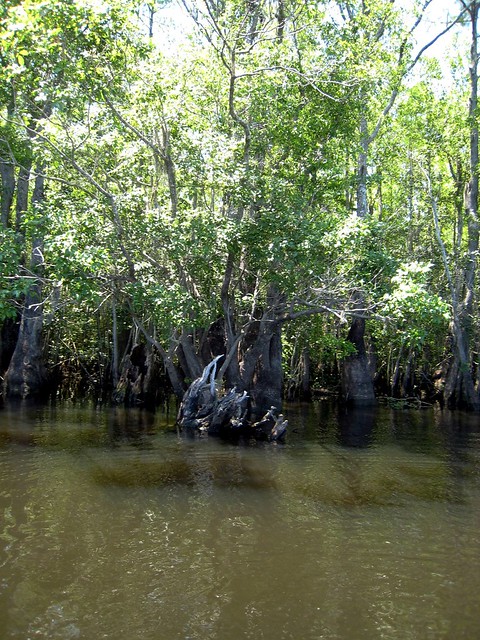
IMG_0013 by ezwater, on Flickr
Here's looking north along the west shore. You can see the end of the beach to the right.
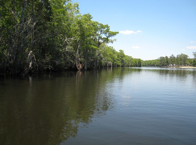
IMG_0014 by ezwater, on Flickr
And here's the view to the south, toward the Escatawpa's tangential contact.
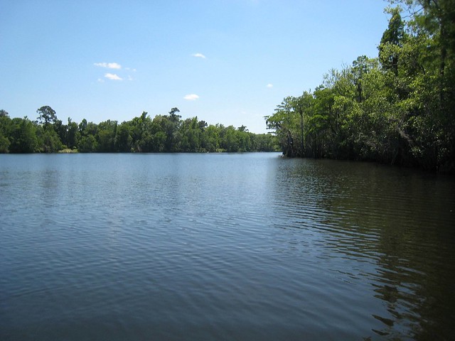
IMG_0015 by ezwater, on Flickr
IMG_0016 by ezwater, on Flickr
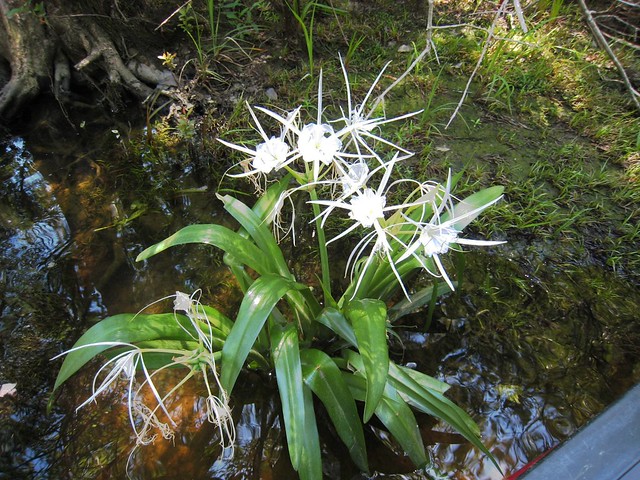
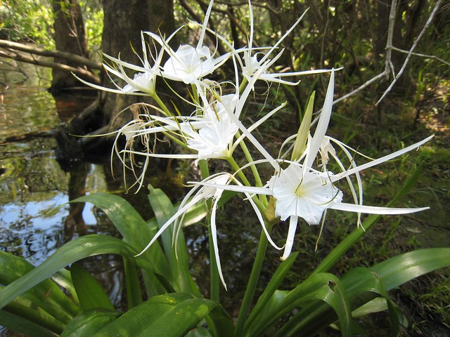
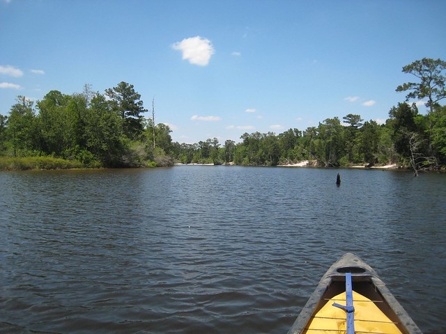
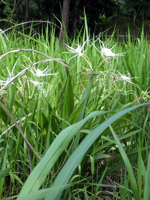
I decided to paddle upstream on the Escatawpa. The current was so low as to be almost imperceptible. Soon, in a side pocket of the river, I came to a surprise---- a close relative of shoal or spider lilies.
IMG_0017 by ezwater, on Flickr
IMG_0018 by ezwater, on Flickr
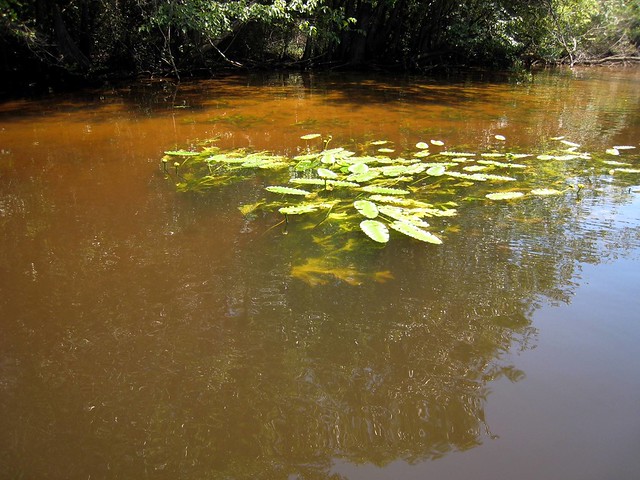
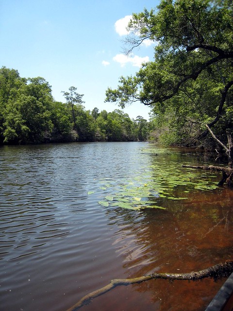
More common were the yellow cup version of water flowers. The leaves were more ruffled at the edges than I have seen before. You can also see the tan color of the water against the white sand. When the water is deeper, it can look black, hence the "blackwater" appelation.
IMG_0020 by ezwater, on Flickr

IMG_0021 by ezwater, on Flickr
IMG_0024 by ezwater, on Flickr
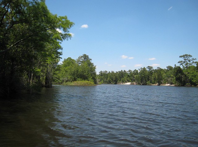
The river is coming down from the north, and sand beaches are more common.
IMG_0025 by ezwater, on Flickr
The red sign indicates an inlet leading to another outfitter, and lists the day's meal deal.
IMG_0027 by ezwater, on Flickr
IMG_0029 by ezwater, on Flickr
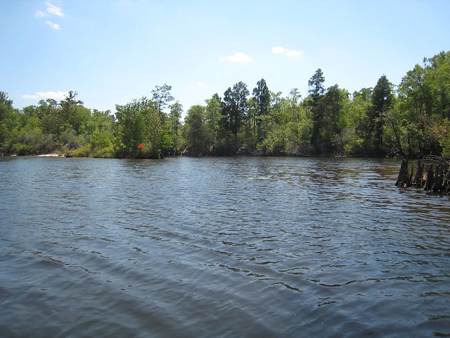
I started paddling back. Here's a mass of snags.
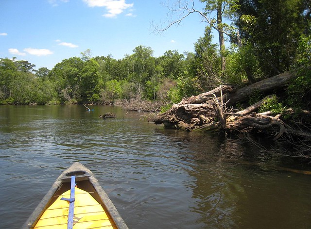
IMG_0030 by ezwater, on Flickr
Because the river is fairly deep and almost tidal, speedboats and jetskis made occasional appearances. They all slowed to a crawl, but their wakes would have been little trouble if they stayed at full speed.
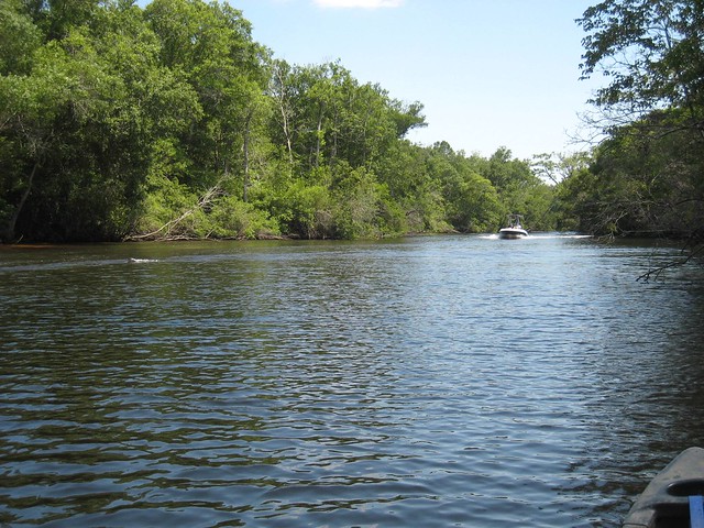
IMG_0031 by ezwater, on Flickr
Back on Goodes Lake, I found another pocket of lilies.
IMG_0034 by ezwater, on Flickr
Back on the beach, loading up the gear and boat.
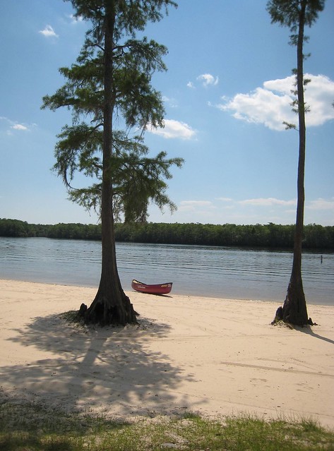
IMG_0036 by ezwater, on Flickr
In wetter times, the Escatawpa can be paddled up where it crosses from Alabama into Mississippi. I understand there's an outfitter up there who will provide shuttle. But during a drought, there's quite a few miles of river above and below Goode's lake where the water stays deep.
EscatawpaSat by ezwater, on Flickr
Goodes Lake is about a mile and a half long, with a small creek at its head. The Escatawpa River comes in from the NW and just touches the south end of Goodes Lake. There are quite a few such lakes on the Escatawpa and similar "blackwater" rivers. I would guess that the river, in periods of high flow, has sucked the sand out of the lake basin through a kind of Bernoulli effect. I have not seen any such lakes where the river enters at the "top" end and leaves at the bottom.
You can also see the cut off meanders, and the obvious white sandbars. Around the river is mostly low ground, flood plain, populated by cypress in the wetter spots and by maple and oak in the drier spots.
Also visible from space are the motor homes lined up along a small canal. The proprietors at Presleys said for me to park and put in along their sand beach, which on a Friday was barely used. The weather was outstanding, temperature in the upper 70s F, and a cooling breeze just stiff enough to require attention. Here's a shot northward along the beach.
IMG_0012 by ezwater, on Flickr
I paddled straight across the lake to poke around in the mass of cypress, willow, and oak along the west shore.
IMG_0013 by ezwater, on Flickr
Here's looking north along the west shore. You can see the end of the beach to the right.
IMG_0014 by ezwater, on Flickr
And here's the view to the south, toward the Escatawpa's tangential contact.
IMG_0015 by ezwater, on Flickr
IMG_0016 by ezwater, on Flickr
I decided to paddle upstream on the Escatawpa. The current was so low as to be almost imperceptible. Soon, in a side pocket of the river, I came to a surprise---- a close relative of shoal or spider lilies.
IMG_0017 by ezwater, on Flickr
IMG_0018 by ezwater, on Flickr
More common were the yellow cup version of water flowers. The leaves were more ruffled at the edges than I have seen before. You can also see the tan color of the water against the white sand. When the water is deeper, it can look black, hence the "blackwater" appelation.
IMG_0020 by ezwater, on Flickr
IMG_0021 by ezwater, on Flickr
IMG_0024 by ezwater, on Flickr
The river is coming down from the north, and sand beaches are more common.
IMG_0025 by ezwater, on Flickr
The red sign indicates an inlet leading to another outfitter, and lists the day's meal deal.
IMG_0027 by ezwater, on Flickr
IMG_0029 by ezwater, on Flickr
I started paddling back. Here's a mass of snags.
IMG_0030 by ezwater, on Flickr
Because the river is fairly deep and almost tidal, speedboats and jetskis made occasional appearances. They all slowed to a crawl, but their wakes would have been little trouble if they stayed at full speed.
IMG_0031 by ezwater, on Flickr
Back on Goodes Lake, I found another pocket of lilies.
IMG_0034 by ezwater, on Flickr
Back on the beach, loading up the gear and boat.
IMG_0036 by ezwater, on Flickr
In wetter times, the Escatawpa can be paddled up where it crosses from Alabama into Mississippi. I understand there's an outfitter up there who will provide shuttle. But during a drought, there's quite a few miles of river above and below Goode's lake where the water stays deep.